
Maps and Views of Derry: 1600-1914, a catalogue
Maps and Views of Derry: 1600-1914, a catalogue
Couldn't load pickup availability
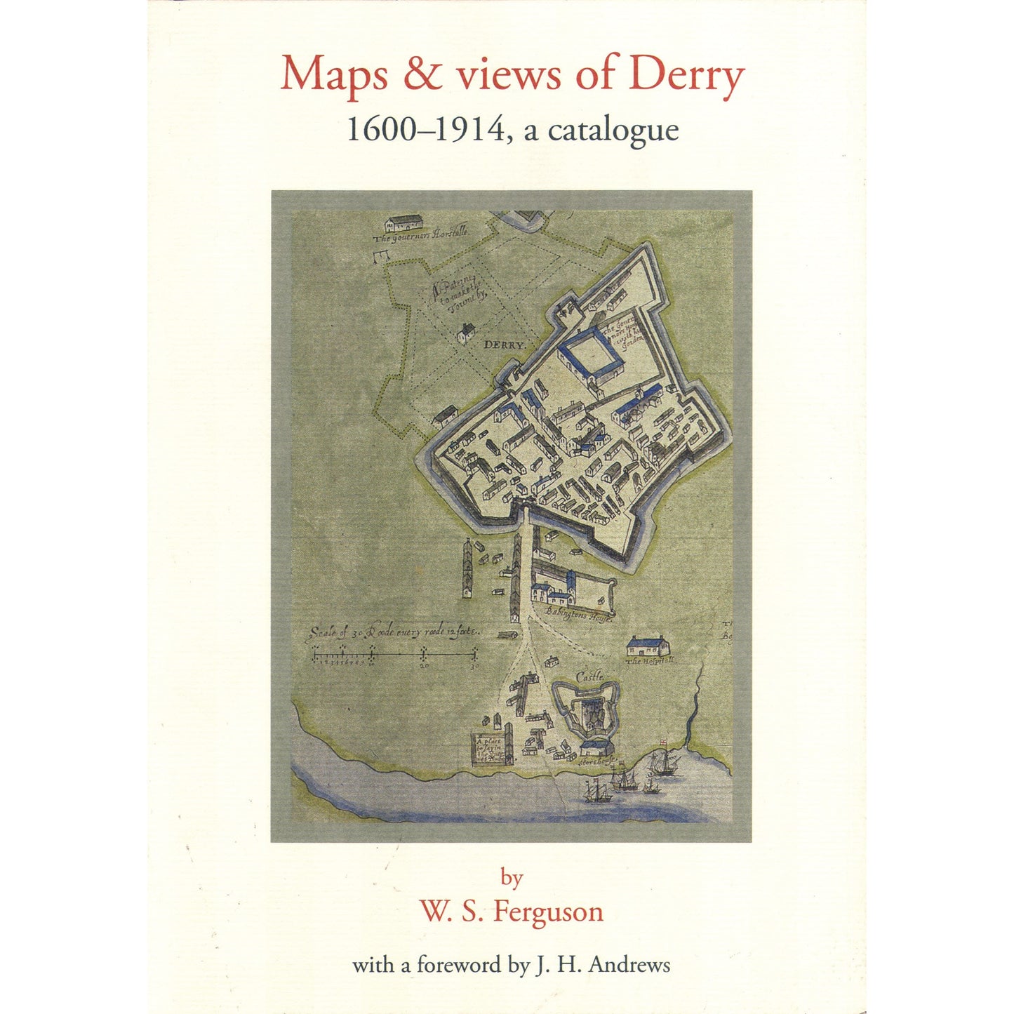
This is part of a number of ancillary publications to the Irish Historic Towns Atlas series. Written by the renowned local historian W.S. Ferguson in the 1960s and 1970s, it brings together an inventory of maps and views of the city of Derry and its environs, which Ferguson was researching and compiling until his death in 1972. By then his work was virtually complete with all his entries drafted. In 2003 the project was adopted by the Royal Irish Academy and published the following year. Special maps such as the Phillips map from 1689 are reproduced in full in this publication. This book makes available the Ferguson manuscript held in the archives in Belfast, PRONI, which for so long was used by scholars and local historians. Foreword by J.H. Andrews.
This is an ancillary publication to Irish Historic Towns Atlas, no. 15, Derry~Londonderry by Avril Thomas.
Author: W.S. Ferguson; Foreword: J.H. Andrews
Series editors: Anngret Simms, H.B. Clarke, Raymond Gillespie; Consultant editor: J.H. Andrews; Cartographic editor: Sarah Gearty; Editorial assistant: Angela Murphy.
The Irish Historic Towns Atlas is a research project of the Royal Irish Academy and is part of a wider European scheme. www.ihta.ie.
Product details
ISBN:9781904890072
Browse Books
-
For and against a united Ireland
Regular price From €9.99 EURRegular priceUnit price per -
Ireland: Why it matters to be an island
Regular price From €9.99 EURRegular priceUnit price per -
Drumcondra
Regular price €35.00 EURRegular priceUnit price per -
An spórt agus an réabhlóid in Éirinn, 1912–25
Regular price From €9.99 EURRegular priceUnit price per


