
Dublin 1847
Dublin 1847
City of the Ordnance Survey
Regular price
€15.00 EUR
Regular price
Sale price
€15.00 EUR
Unit price
per
Couldn't load pickup availability
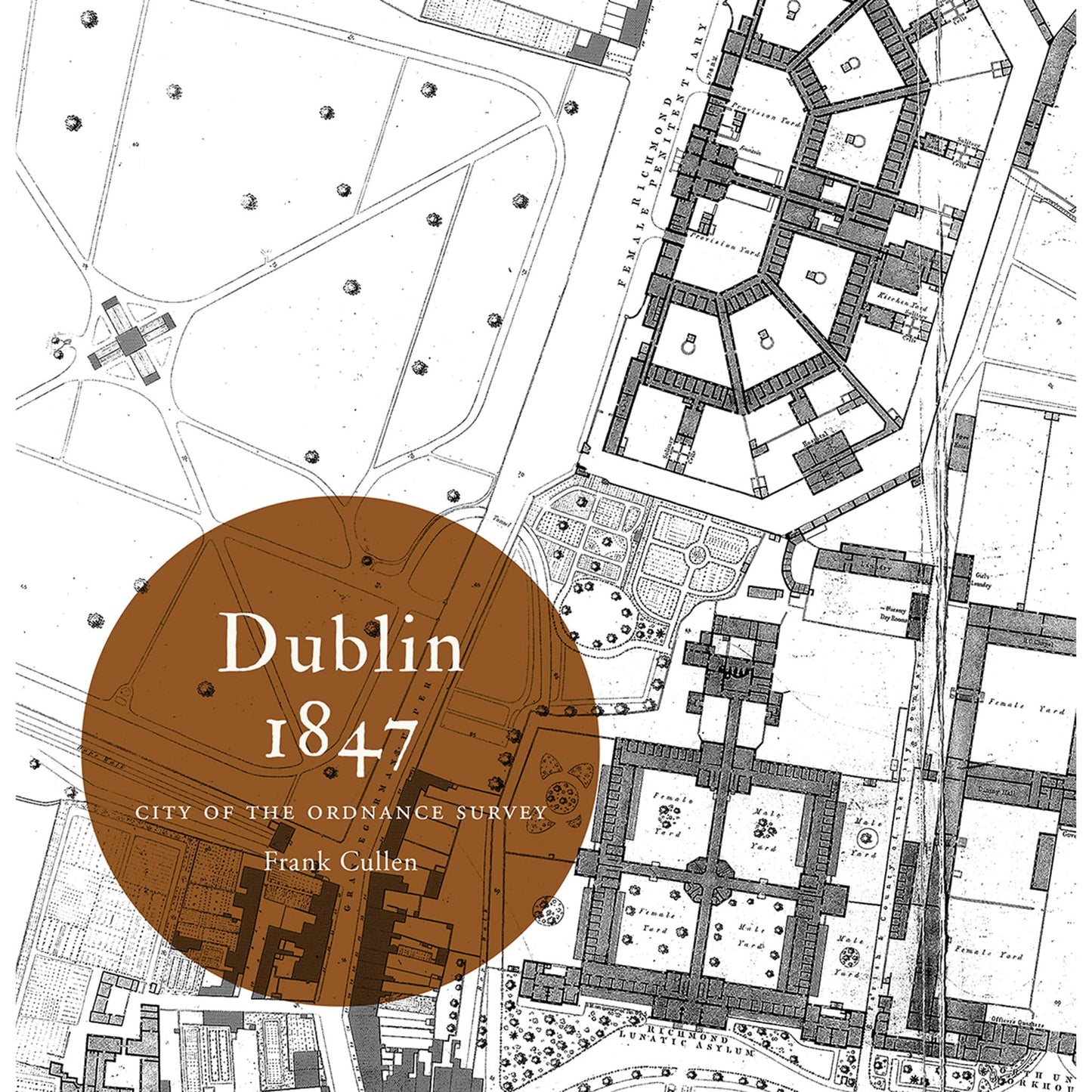
The Ordnance Survey’s large-scale town plans for Dublin (1847) are the focus of this book. Forty-five extracts from these richly detailed maps depict the streets, lanes, buildings, gardens, yards and parks of the city with precision, to the extent that individual houses (with numbers), pumps, lamp posts and trees are shown. Author Frank Cullen considers selected features and areas of the mid-nineteenth-century city through the map extracts, using other sources to discuss the elements of urban life that lie behind maps. For example, the formal layout of Merrion Square with its fine buildings and notable residents is contrasted to the densely inhabited warren of lanes behind Mount Street, just minutes away. The impact of public buildings such as the Royal (later Collins’s) Barracks is impressively evident in the plan, while the associated professional and trading activities of the surrounding area are less obvious in the unlabelled rows of buildings along Montpellier Hill and Barrack (later Benburb) Street. The maps extracts and commentaries are accompanied by contemporary illustrations; and are preceded by an introductory essay on Dublin in 1847.
Product details
ISBN:9781908996350
Publication Date:February 16, 2015
Number of pages:108

Frank Cullen
Browse Books
-
For and against a united Ireland
Regular price From €9.99 EURRegular priceUnit price per -
Ireland: Why it matters to be an island
Regular price From €9.99 EURRegular priceUnit price per -
Drumcondra
Regular price €35.00 EURRegular priceUnit price per -
An spórt agus an réabhlóid in Éirinn, 1912–25
Regular price From €9.99 EURRegular priceUnit price per


